Climate within the different ecozones in the Western Cordillera
Taiga cordillera
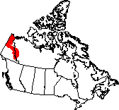
The Taiga Cordillera contains the northernmost of the Rocky mountains in Canada and also some of its highest waterfalls, deepest canyons and wildest rivers. Mountains block much of the precipitation, which averages 250 to 300mm per year. Its northerly position gives it cold winters (-22ºC average temperature) with very short days and short cool summers (average temperature 8ºC). Snow lasts on the ground for six to eight months of the year.
Boreal Cordillera
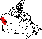
The mountains in the west of the Boreal Cordillera stop much of the precipitation that would normally fall, so the region tends towards dryness, with less than 300 mm of precipitation in the west. Precipitation rises to the east, with up to 1500 mm falling on some slopes. From one third to two-thirds of the precipitation falls as snow. Average winter temperatures are -18ºC, while the short summer averages 10ºC.
pacific Maritime
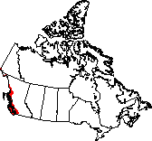
The Pacific Maritime ecozone is Canada's western coastline. Here is where one finds the wettest weather, tallest trees, and deepest fjords in the country. Being so close to the Pacific Ocean, the climate is extremely altered. Summers are cooler, winters more mild. Summer temperatures average 13ºC, while winters average -1.5ºC; there is less difference between winter and summer temperatures here than elsewhere in the country. The mountains block most of the precipitation that clouds would bring to the interior, so precipitation can exceed 4000 mm a year in the north, although some areas get far less than that. The Gulf Islands in the south by contrast receive only 600 mm a year.
Montane Cordillera
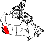
This is the most diverse of the country's ecozones in all respects. The effects of two mountain ranges means that climate varies in all three dimensions. The average annual temperatures in the north of the ecozone is 0.5ºC, in the south 7.5ºC. The dry summers and wetter winters alike are mild, though increased elevation brings lower temperatures.
The Coast Mountains force air masses to rise, where they cool off and lose their moisture as rain or snow, a phenomenon known as orographic precipitation. The western side of the Coast Mountains receives 1200 to 1500mm of precipitation in this way, while the eastern side receives only 300mm in the south and 500 to 800mm in the north and interior due to the dry air that makes it over the mountains. The Rocky Mountains at the eastern edge of the ecozone again catch precipitation, bringing 1200mm of precipitation annually to the western side of the mountains.
The Coast Mountains force air masses to rise, where they cool off and lose their moisture as rain or snow, a phenomenon known as orographic precipitation. The western side of the Coast Mountains receives 1200 to 1500mm of precipitation in this way, while the eastern side receives only 300mm in the south and 500 to 800mm in the north and interior due to the dry air that makes it over the mountains. The Rocky Mountains at the eastern edge of the ecozone again catch precipitation, bringing 1200mm of precipitation annually to the western side of the mountains.
Climate of two cities within the western cordillera
The two graphs bellow show the average climate and precipitation received in Vancouver and Whitehorse. Both of these Cities are in the Western Cordillera.

The climate of the Western Cordillera depends on the area that you are in. It is moist and warm in the summer, and very wet and cold in the winter. The average temperature in the winter is about -12 degrees Celsius, while the average temperature in the summer is about 15 degrees Celsius. The precipitation usually stays around 500 to 1000 millimeters per year, but varies largely depending on the elevation. Some areas with high elevation receive 1200 to 2200 millimeters per year. Those mountains cause rain shadows to fall upon the valleys, causing it to become very dry. The weather fluctuates constantly, and the precipitation is sudden because of relief precipitation. Relief precipitation occurs when air masses rise over the west side of the mountains, causing it to expand, cool, condense, and precipitate.

In the northern part of the Western Cordillera we have the Yukon. The Yukon can be a great place to visit in the summer, but in the winter it has a limited time of actual daylight. In the far north of Yukon, the temperature can be as low as -60. The average temperature in the winter, though, is about -30 degrees Celsius. In the summer it is about 22 degrees Celsius. The climate can vary a lot.
